We just had a cold front pass by in dramatic fashion, at least for Maui. Up until that point, it was a hot and sultry day - a late summer day in late January. The wind was lightly blowing from the south, bringing up some tropical haze. Earlier we drove to Hookipa to check out the waves, and decided it was a touch too crowded and occasionally a touch too big. Nothing dramatic, but we were looking for something more mellow, so we pointed our surf mobile down to Lowers.
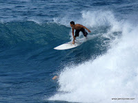
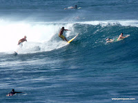
Before leaving I took just a few shots of the action...
At Lowers, we were hoping to find conditions that approached the excellence we experienced the day before. Saturday featured a building swell along with fading winds, a perfect combination for a late afternoon surf session. Sets were showing up in a nice range of sizes, anything from double overhead breaking outside most of the lineup, to gentle head high waves that could be grabbed on the inside. Mostly we stayed inside and took whatever was available. Even the white water of the biggest waves still made for a fun ride, as these waves tended to reform once if not twice on the inner reefs. So we had a great session, and were hoping for something similar.
Though upon arriving it was obvious that the swell had already dropped rapidly and a fleet of SUPs were patrolling whatever was left. But that was OK, because we were perfectly happy spreading out our beach blanket on the dunes and taking in some warm sun. That's one of the nice aspects of living an endless summer. There should always be that option. And one day of rest every, say seven, isn't such a bad idea!
And rest was sorely needed, as last week we had assorted combinations of wind and waves most every day. Monday and Thursday were standout days, where the wind was just strong enough for us windsurfers to get moving, but light enough to keep the waves clean. I've learned to love those days, which have become especially enjoyable due to the combination of a Goya 5.3 eclipse on a Goya 92 lt quad wave board. I'm not sure what the low wind cut off is, but I've been out when it was averaging 17 or so and still managed to catch waves, and once on a wave the 92 lt board cuts it up like a short board (it practically is a short board, being only 232 cm long or 7'7). So we had plenty of action last week and now we were laying on the beach under the hot January sun watching the lazy lowers surf in the distance.
Around 4:25pm, just as another battalion of SUPs arrived, a cool wind suddenly descended on us from the north. At the same time dark clouds which had silently gathered around the West Maui mountains quickly started moving over us, with one of those distinctive dark bands of rolling clouds that marks a cold front boundary. We had been literally laying there in a warm haze with dragonflies playing around us, looking at glassy water, and from our right we could see this line of wind approaching over the water. When it hit it was like going from summer to fall in 30 seconds. The SUP's who had just arrived dropped their boards and their jaws, stuck in the sand by the improbable change in conditions. Coolers and chairs blew over. Families enjoying their Sunday picnics quickly packed up it and ran for their cars. Within ten minutes a cold rain was falling where once there had been warm sun.
In case you think I'm exagerating, here are the wind numbers from iWindurf for Kanaha at that time:
4:44 NNW/342° 25 (20-30)
4:28 NNW/342° 25 (20-30)
4:23 SSE/159° 2 (0-8)
4:07 SSE/159° 1 (0-7)
4:28 NNW/342° 25 (20-30)
4:23 SSE/159° 2 (0-8)
4:07 SSE/159° 1 (0-7)
There you go, from calm to 4.2 wind in under five minutes. That would be sudden even for the Gorge. After retreating from the once warm beach, we headed up the hill to Pukalani. It was a neat drive because the rolling frontal clouds had only made it about half way up Haleakala, with Pukalani barely above the low dark clouds approaching from below. We stopped at a point where we were standing in sun shine with blue skies to our south, while to the north and down slope perhaps only a mile away low clouds were billowing toward us. I had to take some photos - these start out looking south and then turn toward the approaching clouds...
And speaking of sudden changes, tonight a new swell quickly arrives from a hurricane force low not too far to the north. This will create short period extra large surf with a NW dominate direction. NWS Oahu calls for 20-25 ft faces, meaning 10-15 is very likely for Kanaha. But the short period could be a problem - again from NWS " Expect very consistent large surf, but poor conditions and mixed swell due to the proximity of the generating low pressure system". And the wind is forecast to be north to northeast only 15-18. Whether such an onshore direction will be enough to get over the expected large and disorganized surf is a big question. Guess we'll find out tomorrow!
(BTW - you might notice I started watermarking my photos. A week or so ago one of the photos from my Kona post was selected as a "google photo of the day". Nice - this photo has been viewed over 362K times and I'm happy to share it with everyone. That's the point. But it later appeared on a different person's photo site as if taken by them. Also my Haleakala snow picture made it onto other sites (again all good) and some comments asked where the photo came from. So I'm just trying to make it easy for people seeing these photos to find the blog and other similar photos. And glad everyone enjoys them!)


No comments:
Post a Comment